
Overview
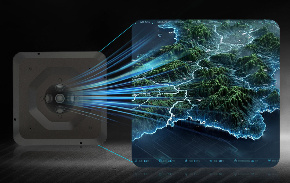
VO305 Series, a new generation of high-performance five-lens oblique camera system engineered for professional photogrammetry and large-scale geospatial surveying. Available in VO305 and VO305 Pro models, the series integrates five 61MP full-frame Exmor R CMOS back-illuminated sensors, delivering an impressive 305-megapixel total resolution for superior image quality, higher mapping efficiency, and exceptional modeling accuracy.
Designed for demanding surveying applications, the VO305 Series combines advanced imaging technology with an intelligent AI-powered architecture to provide surveyors, mapping professionals, and drone operators with a reliable, efficient, and scalable data acquisition solution.
305MP Imaging Performance for High-Precision Mapping
At the heart of the VO305 Series are five synchronized 61MP full-frame sensors equipped with professional prime lenses. This multi-camera configuration captures high-resolution imagery from multiple perspectives in a single flight, significantly improving 3D reconstruction quality while reducing time and costs.
The high-resolution imaging system enables users to generate detailed outputs for:
- Digital Orthophoto Maps (DOM)
- Digital Surface Models (DSM)
- Digital Elevation Models (DEM)
- Digital Line Graphs (DLG)
- Smart City Digital Twins
- High-precision 3D Reality Modeling
Whether deployed for urban planning, land surveying, transportation infrastructure, mining, or emergency mapping, the VO305 Series delivers the image quality required for professional geospatial applications.
AI Computing Platform for Smarter Operations
Unlike conventional oblique cameras, the VO305 Series incorporates a Linux-based AI motherboard with 8GB RAM and 32GB onboard storage, providing significantly enhanced processing capability and system stability.
The intelligent computing platform enables:
- High-speed image processing
- Stable data communication
- SDK-based secondary development
- Flexible Type-C expansion
- Customized application integration
Its open architecture allows system integrators and software developers to build customized workflows tailored to specific industry requirements.
Real-Time Camera Management
Operational efficiency is further enhanced through dual-channel camera control.
Users can monitor camera status directly from the DJI remote controller interface, while camera parameters can also be configured remotely via Wi-Fi using a browser-based WEB interface.
This dual-control approach simplifies field operation and minimizes downtime during aerial missions.
High-Speed Image Capture for Efficient Surveying
The combination of high-speed storage architecture and AI computing enables the VO305 Series to achieve a minimum shooting interval of just one second.
Even during high-speed moving, the camera maintains continuous image acquisition, greatly improving mapping productivity while ensuring complete image coverage across large survey areas.
Integrated Downward Video Transmission
The camera system also supports real-time downward HD video transmission, allowing pilots and operators to monitor flight status and image coverage during missions.
Powered by the onboard AI processor, video transmission remains smooth and reliable throughout demanding aerial operations.
Designed for Professional Unmanned Systems Platforms
With compact dimensions, optimized weight distribution, and robust structural design, the VO305 Series integrates seamlessly with a wide range of professional Unmanned Systems platforms currently available on the market.
Its lightweight design helps maximize move endurance while maintaining outstanding imaging performance.
Built for the Future of Geospatial Intelligence
As industries increasingly demand faster, more accurate, and more intelligent surveying solutions, the VO305 Series provides a powerful combination of ultra-high-resolution imaging, AI-enabled processing, and flexible system integration.
From infrastructure inspection and cadastral surveying to smart city construction and digital twin generation, the VO305 Series empowers professionals to capture richer data, accelerate project delivery, and achieve superior mapping results.
Key Features
- 305MP total resolution with five 61MP full-frame sensors
- Professional prime lenses for superior image quality
- Linux-based AI computing platform
- SDK support for customized development
- Type-C expansion interface
- Minimum 1-second photo interval
- Real-time HD downward video transmission
- Dual-channel parameter configuration via DJI remote controller and Wi-Fi
- Compatible with mainstream Unmanned Systems
Applications
- Aerial Photogrammetry
- 3D Reality Modeling
- Land Surveying
- Urban Planning
- Smart City Construction
- Infrastructure Inspection
- Transportation Corridor Mapping
- Mining & Resource Survey
- Emergency Response Mapping
- Digital Twin Generation
For more details, please visit VO305 Series 305MP Five-Lens Oblique Photography Camera, or Contact us: info@viewprotech.com